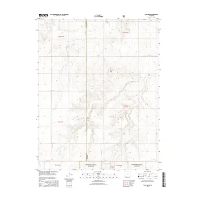
2016 Map of Table Mesa
USGS Topo · Published 2016About this map
Comanche National Grassland encompasses the southern portion of this high plains landscape, where the border of Las Animas and Baca counties runs north to south. The terrain is defined by a network of intermittent drainages and canyons, most notably Burro Arroyo and Freezeout Cr, which carve through the arid plateau. Historical land use is evidenced by the remote Robb Cem located near the intersection of Co RD 223 and Co RD Ee. Water sources, critical for ranching in this environment, are mapped as scattered points such as Watt Spring, O'Hair Spring, and Twin Springs. The eponymous Table Mesa stands as a prominent topographical feature in the northeastern quadrant, overlooking Soldier Canyon and the winding course of Soldier Cr.
Find a feature on this map
32 named features on this map. Tap any name to fly to it.
Don’t see what you’re looking for? This feature index may not catch every label — zoom into the map to look around manually.
Map Details
Editions of this 2016 Table Mesa Map
This is the sole edition of this map. No revisions or reprints were ever made.
Other maps of this area

1891 · Higbee
USGS Topo · 1:125,000

1891 · Springfield
USGS Topo · 1:125,000

1892 · Two Butte
USGS Topo · 1:125,000

1892 · Mt Carrizo
USGS Topo · 1:125,000

1893 · Higbee
USGS Topo · 1:125,000

1893 · Two Butte
USGS Topo · 1:125,000

1893 · Springfield
USGS Topo · 1:125,000

1955 · La Junta
USGS Topo · 1:250,000

1958 · La Junta
USGS Topo · 1:250,000

1968 · La Junta
USGS Topo · 1:250,000