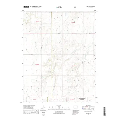
2019 Map of Table Mesa
USGS Topo · Published 2019About this map
The Robb Cem stands as a solitary historical marker within the expansive landscape of southeastern Colorado, where the high plains meet the intricate canyon systems of Comanche National Grassland. The terrain is defined by the prominent Table Mesa, which rises above a network of seasonal watercourses and deeply cut topographic features. These include the steep descents of Soldier Canyon and Cat Canyon, reflecting a landscape carved by the intermittent flow of Burro Arroyo and Freezeout Cr.
Find a feature on this map
30 named features on this map. Tap any name to fly to it.
Don’t see what you’re looking for? This feature index may not catch every label — zoom into the map to look around manually.
Map Details
Editions of this 2019 Table Mesa Map
This is the sole edition of this map. No revisions or reprints were ever made.
Other maps of this area

1891 · Higbee
USGS Topo · 1:125,000

1891 · Springfield
USGS Topo · 1:125,000

1892 · Two Butte
USGS Topo · 1:125,000

1892 · Mt Carrizo
USGS Topo · 1:125,000

1893 · Higbee
USGS Topo · 1:125,000

1893 · Two Butte
USGS Topo · 1:125,000

1893 · Springfield
USGS Topo · 1:125,000

1955 · La Junta
USGS Topo · 1:250,000

1958 · La Junta
USGS Topo · 1:250,000

1968 · La Junta
USGS Topo · 1:250,000