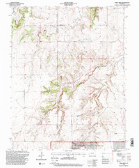
1996 Map of Table Mesa
USGS Topo · Published 2000About this map
The Santa Fe National Historic Trail Granada-Fort Union Route cuts diagonally through this corner of Southeast Colorado, marking a corridor once vital to trade and military transport between the Arkansas River and New Mexico. Situated along the Las Animas and Baca County line, the landscape is defined by the sharp relief of Table Mesa and the deep incisions of Freezeout Canyon and Soldier Canyon.
Find a feature on this map
17 named features on this map. Tap any name to fly to it.
Don’t see what you’re looking for? This feature index may not catch every label — zoom into the map to look around manually.
Map Details
Editions of this 1996 Table Mesa Map
This is the sole edition of this map. No revisions or reprints were ever made.
Other maps of this area

1891 · Higbee
USGS Topo · 1:125,000

1891 · Springfield
USGS Topo · 1:125,000

1892 · Two Butte
USGS Topo · 1:125,000

1892 · Mt Carrizo
USGS Topo · 1:125,000

1893 · Higbee
USGS Topo · 1:125,000

1893 · Two Butte
USGS Topo · 1:125,000

1893 · Springfield
USGS Topo · 1:125,000

1955 · La Junta
USGS Topo · 1:250,000

1958 · La Junta
USGS Topo · 1:250,000

1968 · La Junta
USGS Topo · 1:250,000