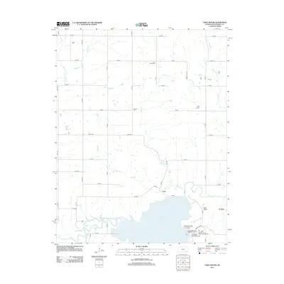
2012 Map of Table Mound
USGS Topo · Published 2012About this map
Elk City Lake dominates the southern landscape of this 2012 topographic study, its shoreline giving way to the winding course of the Elk River. The area maintains a rural, grid-based character defined by a network of county roads such as CR 5000 and CR 6000 that connect small settlements and family burial grounds. For those tracing regional roots, several named cemeteries are preserved here, including White Cem, Farm Ridge Cem, and Simpson Cem. Near the confluence of Gordon Cr and the river, the small settlement of Crane sits just north of the water, while the landmark Table Mound rises to the east near the community of Le Hunt. The map captures the interface between the managed waters of the reservoir and the agricultural uplands, where creeks like Mulberry Cr and Racket Cr drain the plains into the Elk River valley.
Find a feature on this map
45 named features on this map. Tap any name to fly to it.
Don’t see what you’re looking for? This feature index may not catch every label — zoom into the map to look around manually.
Map Details
Editions of this 2012 Table Mound Map
This is the sole edition of this map. No revisions or reprints were ever made.
Other maps of this area

1886 · Independence
USGS Topo · 1:125,000

1894 · Independence
USGS Topo · 1:125,000

1905 · Independence
USGS Topo · 1:125,000

1947 · Joplin
USGS Topo · 1:250,000

1949 · Joplin
USGS Topo · 1:250,000

1954 · Joplin
USGS Topo · 1:250,000

1958 · Joplin
USGS Topo · 1:250,000

1959 · Joplin
USGS Topo · 1:250,000
1959 · Bolton
USGS Topo · 1:24,000
1959 · Neodesha
USGS Topo · 1:24,000