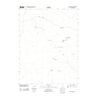
2011 Map of Table Mountain
USGS Topo · Published 2011About this map
Table Mountain and its prominent Carson Table Summit anchor this high-elevation terrain in Churchill County, where seasonal drainage and springs define the landscape's survival. The area is characterized by a complex network of canyons, including the significant Government Trail Canyon and the branching systems of Pete Canyon and Long Canyon. Water sources, though sparse, are carefully documented at named locations such as Stone House Spring, Elevenmile Springs, and Trap Corral Spring, which likely served as critical waypoints for early travelers and livestock. The prominence of summits like Mount Lincoln, Shaly Peak, and Slaughter Peaks provides clear navigational landmarks across the basin. This survey illustrates the intricate topography of the Nevada interior, where the flow of Salt Creek and the presence of sheltered sites like Huckleberry Canyon suggest a landscape used primarily for transit and high-desert grazing.
Find a feature on this map
25 named features on this map. Tap any name to fly to it.
Don’t see what you’re looking for? This feature index may not catch every label — zoom into the map to look around manually.
Map Details
Editions of this 2011 Table Mountain Map
This is the sole edition of this map. No revisions or reprints were ever made.
Other maps of this area

1908 · Carson Sink
USGS Topo · 1:250,000

1910 · Carson Sink
USGS Topo · 1:250,000

1957 · Reno
USGS Topo · 1:250,000

1959 · Reno
USGS Topo · 1:250,000

1960 · Reno
USGS Topo · 1:250,000

1969 · Cox Canyon
USGS Topo · 1:24,000

1969 · Table Mtn
USGS Topo · 1:24,000

1969 · Pintail Bay
USGS Topo · 1:24,000

1969 · Foxtail Lake
USGS Topo · 1:24,000

1972 · Pirouette Mtn
USGS Topo · 1:24,000