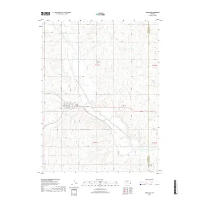
2017 Map of Table Rock
USGS Topo · Published 2017About this map
Table Rock serves as the central hub for this southeastern Nebraska landscape, situated near the winding course of the North Fork Big Nemaha River. The town's grid is clearly defined by streets such as Grand St, Pennsylvania St, and Wyoming St, illustrating a compact rural settlement pattern. The surrounding agricultural sections are drained by a network of waterways including Kirkham Cr, Round Grove Cr, and Clear Cr. Local heritage is anchored by several burial sites, such as Saint Johns Cem to the north and the Bohemian Cem to the east, reflecting the cultural roots of the early residents. The arrival of transportation is evidenced by Railroad Dr, which tracks alongside the river, while the eastern boundary of the sheet follows the line between Pawnee and Richardson Counties.
Find a feature on this map
38 named features on this map. Tap any name to fly to it.
Don’t see what you’re looking for? This feature index may not catch every label — zoom into the map to look around manually.
Map Details
Editions of this 2017 Table Rock Map
This is the sole edition of this map. No revisions or reprints were ever made.
Other maps of this area

1915 · Howe
USGS Topo · 1:62,500

1916 · Humboldt
USGS Topo · 1:62,500

1955 · Nebraska City
USGS Topo · 1:250,000

1955 · Lincoln
USGS Topo · 1:250,000

1957 · Nebraska City
USGS Topo · 1:250,000

1957 · Lincoln
USGS Topo · 1:250,000

1958 · Lincoln
USGS Topo · 1:250,000

1958 · Nebraska City
USGS Topo · 1:250,000

1965 · Pawnee City
USGS Topo · 1:24,000

1965 · Table Rock
USGS Topo · 1:24,000