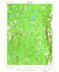
1946 Map of Taborton
USGS Topo · Published 1966About this map
East Poestenkill serves as a primary settlement point in this mid-century landscape, situated along the winding course of Poesten Kill. The area is characterized by a dense network of water bodies and small rural communities that reflect the agricultural and early recreational character of Rensselaer County. Prominent upland features such as Perigo Hill and The Gipfel overlook a terrain dotted with family-named landmarks like Snyder Cem and Snyder Sch.
Find a feature on this map
40 named features on this map. Tap any name to fly to it.
Don’t see what you’re looking for? This feature index may not catch every label — zoom into the map to look around manually.
Map Details
Editions of this 1946 Taborton Map
3 editions found
Other maps of this area

1888 · Berlin
USGS Topo · 1:62,500

1890 · Berlin
USGS Topo · 1:62,500

1893 · Cohoes
USGS Topo · 1:62,500

1893 · Troy
USGS Topo · 1:62,500

1894 · Berlin
USGS Topo · 1:62,500

1895 · Troy
USGS Topo · 1:62,500

1895 · Cohoes
USGS Topo · 1:62,500

1897 · Hoosick
USGS Topo · 1:62,500

1898 · Berlin
USGS Topo · 1:62,500

1898 · Cohoes
USGS Topo · 1:62,500