
Loading...
Loading map...1975 Map of Tacoma
USGS Topo · Published 1977About this map
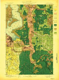
The Puget Sound and its complex network of inlets and islands dominate this mid-1970s landscape, illustrating a region defined by maritime geography and massive federal footprints. The Fort Lewis Military Reservation and Mcchord Air Force Base occupy a vast southern expanse, while the McNeil Island Penitentiary sits isolated within Carr Inlet.
Find a feature on this map
224 named features on this map. Tap any name to fly to it.
Don’t see what you’re looking for? This feature index may not catch every label — zoom into the map to look around manually.
Map Details
Date Portrayed1975
Date Published1977
PublisherU.S. Geological Survey
Map TypeTopographic
Scale1:100000
Physical Dimensions33.2 x 28.3 inches
Editions of this 1975 Tacoma Map
This is the sole edition of this map. No revisions or reprints were ever made.
Historical Maps of Barnes Lake Condominiums Through Time
4 maps found

Featured Locations
Source Details
SourceU.S. Geological Survey
CopyrightPublic Domain