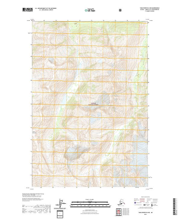
2021 Map of Taku River B-6 NE
USGS Topo · Published 2021About this map
Tongass National Forest covers much of this high-altitude landscape within the Coast Mountains of Alaska. This survey details a terrain of extreme verticality, defined by the drainage systems of Fehring Cr and Hidden Cr as they move toward the coast. The map illustrates a wilderness largely untouched by development, focusing instead on the natural topography and the watershed that feeds into Taku Inlet. The prominence of Mt Swineford serves as a central landmark amidst the steep contour lines, providing a detailed look at the glacially influenced geography of the Juneau City and Borough region. For researchers, the map provides precise boundary data for several townships including t39s r70e and t40s r71e, marking the intersection of public land surveys and the national forest boundary.
Find a feature on this map
10 named features on this map. Tap any name to fly to it.
Don’t see what you’re looking for? This feature index may not catch every label — zoom into the map to look around manually.
Map Details
Editions of this 2021 Taku River B-6 NE Map
This is the sole edition of this map. No revisions or reprints were ever made.
Other maps of this area

1951 · Taku River B-6
USGS Topo · 1:63,360

1951 · Taku River B-5
USGS Topo · 1:63,360

1953 · Taku River
USGS Topo · 1:250,000
1960 · Taku River C-5
USGS Topo · 1:63,360

1960 · Taku River C-6
USGS Topo · 1:63,360

1960 · Taku River
USGS Topo · 1:250,000

1994 · Taku River B-6
USGS Topo · 1:63,360

1995 · Taku River C-6
USGS Topo · 1:63,360
2017 · Taku River B-5 SW
USGS Topo · 1:25,000
2017 · Taku River C-6 SW
USGS Topo · 1:25,000