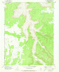
1970 Map of Tall Mountain NW
USGS Topo · Published 1973About this map
Piute Canyon carves a deep path through the high desert landscape of the Navajo Indian Reservation, serving as the central geographic feature of this 1970 field-checked survey. The map reveals evidence of ancient habitation through several marked Ruins and a specific Cliff Dwelling tucked into the canyon walls. These archaeological sites are joined by physical markers of later exploration, such as a Drill Hole and a winding Pack Trail that follows the contour of the terrain. The high elevation of Piute Mesa and the Shonto Plateau overlook the canyon floor, where the presence of Falls indicates the seasonal movement of water through this arid environment. Bordering the junction of San Juan, Navajo, and Coconino counties, the area remains defined by its natural barriers and sparse human footprints, connected primarily by primitive trails rather than established roads.
Find a feature on this map
12 named features on this map. Tap any name to fly to it.
Don’t see what you’re looking for? This feature index may not catch every label — zoom into the map to look around manually.
Map Details
Editions of this 1970 Tall Mountain NW Map
This is the sole edition of this map. No revisions or reprints were ever made.
Other maps of this area

1883 · Marsh Pass
USGS Topo · 1:250,000

1886 · Henry Mountains
USGS Topo · 1:250,000

1892 · Marsh Pass
USGS Topo · 1:250,000

1892 · Henry Mountains
USGS Topo · 1:250,000

1952 · Shato Spring 1 NE
USGS Topo · 1:24,000

1952 · Navajo Mtn. 4 SE
USGS Topo · 1:24,000

1953 · Navajo Mountain 4 SW
USGS Topo · 1:24,000

1953 · Navajo Mountain
USGS Topo · 1:62,500

1953 · No Mans Mesa
USGS Topo · 1:62,500

1956 · Escalante
USGS Topo · 1:250,000