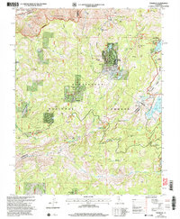
2001 Map of Tamarack
USGS Topo · Published 2004About this map
Bloods Toll Sta Hist Site stands as a reminder of early trans-Sierra travel in this high-country region where Calaveras and Alpine counties meet. The map documents a landscape defined by winter recreation and timber management within the Stanislaus National Forest, showing the development of Bear Valley and the Bear Valley Ski Area alongside seasonal settlements like Sherman Acres and Tamarack.
Find a feature on this map
50 named features on this map. Tap any name to fly to it.
Don’t see what you’re looking for? This feature index may not catch every label — zoom into the map to look around manually.
Map Details
Editions of this 2001 Tamarack Map
2 editions found
Other maps of this area

1889 · Pyramid Peak
USGS Topo · 1:125,000

1889 · Markleeville
USGS Topo · 1:125,000

1891 · Markleeville
USGS Topo · 1:125,000

1891 · Big Trees
USGS Topo · 1:125,000

1891 · Pyramid Peak
USGS Topo · 1:125,000

1893 · Markleeville
USGS Topo · 1:125,000

1894 · Big Trees
USGS Topo · 1:125,000

1895 · Pyramid Peak
USGS Topo · 1:125,000

1896 · Dardanelles
USGS Topo · 1:125,000

1896 · Pyramid Peak
USGS Topo · 1:125,000