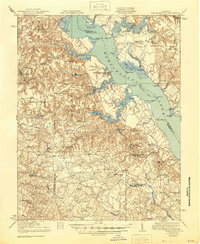
1918 Map of Tappahannock
USGS Topo · Published 1944About this map
Tappahannock serves as the focal point of this Tidewater survey, situated where the broad Rappahannock River dictates the region's commerce and transport. The map traces the vital Steamboat Route connecting various riverfront landings, including Islington Landing and Wares Wharf, which were essential for moving agricultural goods before modern highway dominance. Inland, the landscape is defined by the dense, winding waters of Dragon Swamp and Exol Swamp, which constrained early settlement patterns and road networks.
Find a feature on this map
76 named features on this map. Tap any name to fly to it.
Don’t see what you’re looking for? This feature index may not catch every label — zoom into the map to look around manually.
Map Details
Editions of this 1918 Tappahannock Map
2 editions found

Other maps of this area

1889 · Fredericksburg
USGS Topo · 1:125,000

1892 · Fredericksburg
USGS Topo · 1:125,000

1892 · Piney Point
USGS Topo · 1:62,500

1892 · Montross
USGS Topo · 1:62,500

1894 · Fredericksburg
USGS Topo · 1:125,000

1894 · Piney Point
USGS Topo · 1:62,500

1895 · Nomini
USGS Topo · 1:125,000

1895 · Piney Point
USGS Topo · 1:62,500

1895 · Montross
USGS Topo · 1:62,500

1898 · Nomini
USGS Topo · 1:125,000