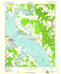
1944 Map of Tappahannock
USGS Topo · Published 1961About this map
Tappahannock serves as the focal point of this mid-1940s landscape, positioned on the western bank where the Downing Bridge connects Essex and Richmond counties. The town's layout shows established institutions like St Margarets Sch, while the surrounding countryside is dotted with historic estates and rural settlements. To the northeast, the town of Warsaw anchors the Richmond County side, surrounded by landmarks like the Sabine Hall estate and Mt Airy.
Find a feature on this map
35 named features on this map. Tap any name to fly to it.
Don’t see what you’re looking for? This feature index may not catch every label — zoom into the map to look around manually.
Map Details
Editions of this 1944 Tappahannock Map
2 editions found

Other maps of this area

1892 · Piney Point
USGS Topo · 1:62,500

1892 · Montross
USGS Topo · 1:62,500

1894 · Piney Point
USGS Topo · 1:62,500

1895 · Nomini
USGS Topo · 1:125,000

1895 · Piney Point
USGS Topo · 1:62,500

1895 · Montross
USGS Topo · 1:62,500

1898 · Nomini
USGS Topo · 1:125,000

1901 · Piney Point
USGS Topo · 1:62,500

1917 · Morattico
USGS Topo · 1:62,500

1918 · Tappahannock
USGS Topo · 1:62,500