
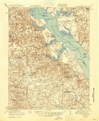
1918 Map of Tappahannock
USGS Topo · Published 1918About this map
Tappahannock serves as the focal point of this 1917 survey, sitting at a critical narrows of the Rappahannock River where a ferry once connected the town to the Richmond County shore. The landscape is defined by the tidal reaches of the river and its numerous landings, including Islington Landing and Wares Wharf, which were vital hubs for the Steamboat Route that moved goods and people through the Tidewater region. On the northern bank, the historic estates of Sabine Hall and Mt Airy anchor the high ground overlooking Cat Point Creek. Moving inland, the map details a dense network of mills and crossroads that powered the local economy, such as Croxton Mill and Scott Mill. The presence of the Rappahannock Industrial Academy and numerous rural schools like Pinetop School reflects the community's early twentieth-century social infrastructure amidst the marshes of Dragon Swamp and Piscataway Creek.
Find a feature on this map
77 named features on this map. Tap any name to fly to it.
Don’t see what you’re looking for? This feature index may not catch every label — zoom into the map to look around manually.
Map Details
Editions of this 1918 Tappahannock Map
2 editions found
Other maps of this area

1889 · Fredericksburg
USGS Topo · 1:125,000

1892 · Fredericksburg
USGS Topo · 1:125,000

1892 · Piney Point
USGS Topo · 1:62,500

1892 · Montross
USGS Topo · 1:62,500

1894 · Fredericksburg
USGS Topo · 1:125,000

1894 · Piney Point
USGS Topo · 1:62,500

1895 · Nomini
USGS Topo · 1:125,000

1895 · Piney Point
USGS Topo · 1:62,500

1895 · Montross
USGS Topo · 1:62,500

1898 · Nomini
USGS Topo · 1:125,000