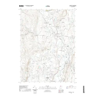
2021 Map of Tariffville
USGS Topo · Published 2021About this map
Metacomet Ridge dominates the landscape of this Hartford County corridor, where the Farmington River carves through the basalt highlands at Tariffville. The settlement pattern follows a series of historic village centers, from Simsbury Center and Hoskins in the south to Granby and Salmon Brook further north. This modern survey illustrates how early infrastructure has been repurposed for recreation, most notably where the Farmington Canal Trl and Farmington Valley Greenway Trl trace the path of 19th-century transport routes. Local history is preserved in numerous burial grounds, including the Baptist Cem and Saint Andrews Cem, while the rugged heights of Manitook Mtn and Talcott Mtn flank the developed valley floors. The presence of the Simsbury Airport near Lake Basile highlights the area's continued role as a regional hub.
Find a feature on this map
83 named features on this map. Tap any name to fly to it.
Don’t see what you’re looking for? This feature index may not catch every label — zoom into the map to look around manually.
Map Details
Editions of this 2021 Tariffville Map
This is the sole edition of this map. No revisions or reprints were ever made.
Other maps of this area

1886 · Springfield
USGS Topo · 1:62,500

1887 · Granville
USGS Topo · 1:62,500

1889 · Springfield
USGS Topo · 1:62,500

1889 · Granville
USGS Topo · 1:62,500

1892 · Hartford
USGS Topo · 1:62,500

1892 · Granby
USGS Topo · 1:62,500

1893 · Springfield
USGS Topo · 1:62,500

1893 · Granville
USGS Topo · 1:62,500

1895 · Springfield
USGS Topo · 1:62,500

1895 · Granville
USGS Topo · 1:62,500