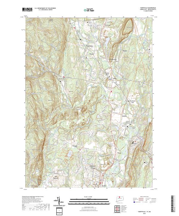
2024 Map of Tariffville
USGS Topo · Published 2024About this map
Simsbury Center and the surrounding villages of Tariffville, Granby, and West Simsbury occupy a landscape defined by the varied terrain of Metacomet Ridge and Talcott Mtn. The Lower Farmington River and Salmon Brook corridor remains a central geographic feature, while historical land use is evidenced by numerous burial grounds such as Saint Bernard Cem and the Hartford Mutual Society Memorial Park. The presence of the Farmington Canal Trail indicates the path of early transportation infrastructure that once connected these communities to broader trade networks.
Find a feature on this map
169 named features on this map. Tap any name to fly to it.
Don’t see what you’re looking for? This feature index may not catch every label — zoom into the map to look around manually.
Map Details
Editions of this 2024 Tariffville Map
This is the sole edition of this map. No revisions or reprints were ever made.
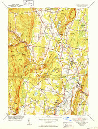
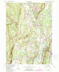
Historical Maps of Granbrook Park Through Time
3 maps found