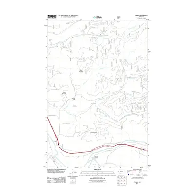
2011 Map of Tarkio
USGS Topo · Published 2011About this map
The settlement of Tarkio sits at the base of the mountains along the Clark Fork river, anchoring a landscape shaped by narrow gulches and high peaks in Mineral County. This early 21st-century survey documents the network of Forest Service roads and ranch tracks that thread through the peaks, including Miller Mountain, Graham Mountain, and Martel Mountain. The presence of the Gold King Mine and Roosevelt Mine highlights the area's legacy of extraction, while the Tarkio Cemetery and Fish Creek Cemetery provide essential points of reference for local genealogical research. Waterways like Nemote Creek and Miller Creek drain the surrounding heights into the primary river valley, defining the topography that forced early transportation routes—such as the Old Hwy 10 W and Lower Fish Creek Rd—to follow the natural curves of the Clark Fork.
Find a feature on this map
41 named features on this map. Tap any name to fly to it.
Don’t see what you’re looking for? This feature index may not catch every label — zoom into the map to look around manually.
Map Details
Editions of this 2011 Tarkio Map
This is the sole edition of this map. No revisions or reprints were ever made.
Other maps of this area

1911 · Lolo
USGS Topo · 1:250,000

1913 · Lolo
USGS Topo · 1:250,000

1956 · Wallace
USGS Topo · 1:250,000

1956 · Hamilton
USGS Topo · 1:250,000

1959 · Hamilton
USGS Topo · 1:250,000

1959 · Tarkio
USGS Topo · 1:62,500

1960 · Wallace
USGS Topo · 1:250,000

1960 · Hamilton
USGS Topo · 1:250,000

1960 · Superior
USGS Topo · 1:62,500

1960 · Straight Peak
USGS Topo · 1:62,500