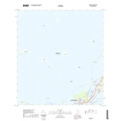
2021 Map of Tavernier
USGS Topo · Published 2021About this map
Islamorada, Village of Islands serves as the focal point for this 2021 survey, where the narrow ribbons of Plantation Key and Key Largo meet at Tavernier Creek. The map documents a complex aquatic landscape where the shallow waters of Florida Bay transition into the Atlantic Ocean via the Hawk Channel. This modern study illustrates the dense network of local roads and water routes that define life in the Middle Keys, from residential corridors like Burton Dr and Normandy Dr to the Intracoastal Waterway. To the west, the protected expanse of Everglades National Park encompasses numerous islets and banks, including Stake Key, Bottle Key, and Upper Cross Bank. Transportation infrastructure is heavily represented, featuring the Old Overseas Hwy, the Florida Keys Overseas Heritage Trail, and the Tavernaero Park Airport runway serving the community of Tavernier.
Find a feature on this map
46 named features on this map. Tap any name to fly to it.
Don’t see what you’re looking for? This feature index may not catch every label — zoom into the map to look around manually.
Map Details
Editions of this 2021 Tavernier Map
This is the sole edition of this map. No revisions or reprints were ever made.
Other maps of this area

1947 · Rock Harbor
USGS Topo · 1:24,000

1947 · Blackwater Sound
USGS Topo · 1:24,000

1949 · Blackwater Sound
USGS Topo · 1:24,000

1949 · Rock Harbor
USGS Topo · 1:24,000

1956 · Miami
USGS Topo · 1:250,000

1958 · Miami
USGS Topo · 1:250,000

1971 · Upper Matecumbe Key
USGS Topo · 1:24,000

1971 · Tavernier
USGS Topo · 1:24,000

1971 · Plantation Key
USGS Topo · 1:24,000

1972 · Madeira Bay
USGS Topo · 1:24,000