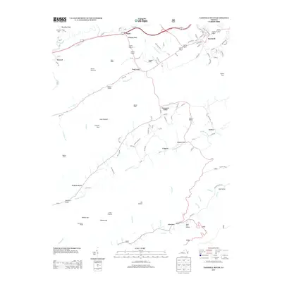
2013 Map of Tazewell South
USGS Topo · Published 2013About this map
Tazewell sits at the northern edge of this landscape, where the headwaters of the Clinch River begin their journey through the Appalachian highlands. The area is defined by a series of parallel ridges and agricultural valleys, most notably Witten Valley and Thompson Valley, which have long supported rural settlements. Historic sites such as Wittens Fort and Pisgah mark early frontier positions, while small community hubs like Pucketts Store and Asberrys indicate the persistent local-service patterns of the region. The map reveals a transition from the structured street grid of the county seat to the winding country roads like Pleasant Church Rd that follow the natural contours of the valley floors. Prominent landmarks such as Deskin Mountain, Knob Mountain, and Chimney Rock separate the watersheds of Maiden Spring Cr and Plum Cr, creating a geography of isolated but interconnected hollows like Possum Hollow and Sugar Tree Hollow.
Find a feature on this map
115 named features on this map. Tap any name to fly to it.
Don’t see what you’re looking for? This feature index may not catch every label — zoom into the map to look around manually.
Map Details
Editions of this 2013 Tazewell South Map
This is the sole edition of this map. No revisions or reprints were ever made.
Other maps of this area

1887 · Pocahontas
USGS Topo · 1:125,000

1889 · Wytheville
USGS Topo · 1:125,000

1891 · Tazewell
USGS Topo · 1:125,000

1891 · Pocahontas
USGS Topo · 1:125,000

1891 · Abingdon
USGS Topo · 1:125,000

1892 · Wytheville
USGS Topo · 1:125,000

1894 · Pocahontas
USGS Topo · 1:125,000

1894 · Abingdon
USGS Topo · 1:125,000

1895 · Tazewell
USGS Topo · 1:125,000

1895 · Pocahontas
USGS Topo · 1:125,000