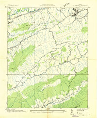
1934 Map of Tazewell
USGS Topo · Published 1934About this map
Tazewell serves as the primary hub in this 1934 survey, situated near the headwaters of Town Branch and the Jeffersonville Cem. The landscape is defined by the steep ridges of Clinch Mountain and Paint Lick Mountain, which channel settlement and transportation through long valleys like Thompson Valley. Along the banks of Maiden Spring Creek, early industrial activity is evident at Creagers Mill, while the extraction economy is represented by operations at Pounding Mill No 10.
Find a feature on this map
59 named features on this map. Tap any name to fly to it.
Don’t see what you’re looking for? This feature index may not catch every label — zoom into the map to look around manually.
Map Details
Editions of this 1934 Tazewell Map
This is the sole edition of this map. No revisions or reprints were ever made.
Other maps of this area

1887 · Pocahontas
USGS Topo · 1:125,000

1889 · Wytheville
USGS Topo · 1:125,000

1891 · Tazewell
USGS Topo · 1:125,000

1891 · Pocahontas
USGS Topo · 1:125,000

1891 · Abingdon
USGS Topo · 1:125,000

1892 · Wytheville
USGS Topo · 1:125,000

1894 · Pocahontas
USGS Topo · 1:125,000

1894 · Abingdon
USGS Topo · 1:125,000

1895 · Tazewell
USGS Topo · 1:125,000

1895 · Pocahontas
USGS Topo · 1:125,000