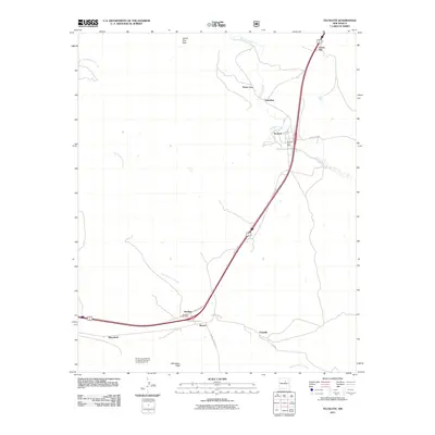
2011 Map of Tecolote
USGS Topo · Published 2011About this map
Serafina and Bernal serve as primary anchors along the historic transportation corridor of San Miguel County, where modern highway infrastructure parallels the traditional San Jose Road. The landscape is defined by its drainage systems, specifically Tecolote Creek and Tres Hermanos Creek, which have influenced the siting of small settlements like Santa Ana and Gabaldon. The presence of the Serafina Post Office and Tecolote Post Office suggests these locales maintained their roles as community hubs into the 21st century. Significant terrain markers such as Starvation Peak and Cañon Pino Real provide geographical context to the north-south movement through the region. Of particular interest to historical researchers is the Bernal Lone Butte SE of Station Thompson Airway Beacon 32, an aviation landmark that connects the area's geography to early mid-century aerial navigation systems.
Find a feature on this map
20 named features on this map. Tap any name to fly to it.
Don’t see what you’re looking for? This feature index may not catch every label — zoom into the map to look around manually.
Map Details
Editions of this 2011 Tecolote Map
This is the sole edition of this map. No revisions or reprints were ever made.
Other maps of this area

1889 · Las Vegas
USGS Topo · 1:125,000

1890 · Bernal
USGS Topo · 1:125,000

1891 · Bernal
USGS Topo · 1:125,000

1891 · Las Vegas
USGS Topo · 1:125,000

1893 · Las Vegas
USGS Topo · 1:125,000

1894 · Bernal
USGS Topo · 1:125,000

1954 · Santa Fe
USGS Topo · 1:250,000

1958 · Santa Fe
USGS Topo · 1:250,000

1960 · Villanueva
USGS Topo · 1:62,500

1960 · Apache Springs
USGS Topo · 1:62,500