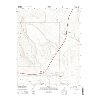
2013 Map of Tecolote
USGS Topo · Published 2013About this map
Serafina and Bernal anchor this portion of San Miguel County, where the high-plains landscape is deeply carved by the waters of Tecolote Cr and Tres Hermanos Cr. The terrain is dominated by the prominent landmark of Starvation Peak, which rises above the valley near the intersection of the primary transportation corridor and the Santa Fe National Forest boundary. Small, dispersed settlements like Gabaldon, Santa Ana, and Cedar Hill reflect a long-standing pattern of mountain-fringe habitation and ranching. Genealogists may find value in the specific locations of rural post offices designated by Po labels and local road networks such as Baez Ln and CO Road B-28-A. The survey also marks the Bernal Lone Butte airway beacon, a remnant of mid-century aerial navigation infrastructure near Blanchard.
Find a feature on this map
26 named features on this map. Tap any name to fly to it.
Don’t see what you’re looking for? This feature index may not catch every label — zoom into the map to look around manually.
Map Details
Editions of this 2013 Tecolote Map
This is the sole edition of this map. No revisions or reprints were ever made.
Other maps of this area

1889 · Las Vegas
USGS Topo · 1:125,000

1890 · Bernal
USGS Topo · 1:125,000

1891 · Bernal
USGS Topo · 1:125,000

1891 · Las Vegas
USGS Topo · 1:125,000

1893 · Las Vegas
USGS Topo · 1:125,000

1894 · Bernal
USGS Topo · 1:125,000

1954 · Santa Fe
USGS Topo · 1:250,000

1958 · Santa Fe
USGS Topo · 1:250,000

1960 · Villanueva
USGS Topo · 1:62,500

1960 · Apache Springs
USGS Topo · 1:62,500