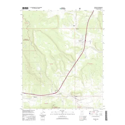
2017 Map of Tecolote
USGS Topo · Published 2017About this map
Serafina and Tecolote anchor this portion of San Miguel County, situated along the corridor of the modern interstate and older routes like Old Hwy 84 S. The map reveals a cluster of small settlements including Bernal, Blanchard, and Chapelle that define the local social geography. These communities are positioned near the drainage of Tecolote Creek, which winds through the valley floor beneath the prominent rise of Starvation Peak to the south.
Find a feature on this map
39 named features on this map. Tap any name to fly to it.
Don’t see what you’re looking for? This feature index may not catch every label — zoom into the map to look around manually.
Map Details
Editions of this 2017 Tecolote Map
This is the sole edition of this map. No revisions or reprints were ever made.
Other maps of this area

1889 · Las Vegas
USGS Topo · 1:125,000

1890 · Bernal
USGS Topo · 1:125,000

1891 · Bernal
USGS Topo · 1:125,000

1891 · Las Vegas
USGS Topo · 1:125,000

1893 · Las Vegas
USGS Topo · 1:125,000

1894 · Bernal
USGS Topo · 1:125,000

1954 · Santa Fe
USGS Topo · 1:250,000

1958 · Santa Fe
USGS Topo · 1:250,000

1960 · Villanueva
USGS Topo · 1:62,500

1960 · Apache Springs
USGS Topo · 1:62,500