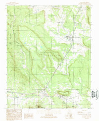
1989 Map of Tecolote
USGS Topo · Published 1989About this map
Tecolote sits at the heart of this landscape where the high mesa country meets the drainage of Tecolote Creek. This late-twentieth-century survey documents a string of communities and rural outposts along the primary transportation corridor, including Serafina, Bernal, and Blanchard. The map reveals the historical footprint of the region through labels like Santa Ana (Site), indicating a location of former habitation near Gabaldon.
Find a feature on this map
37 named features on this map. Tap any name to fly to it.
Don’t see what you’re looking for? This feature index may not catch every label — zoom into the map to look around manually.
Map Details
Editions of this 1989 Tecolote Map
This is the sole edition of this map. No revisions or reprints were ever made.
Other maps of this area

1889 · Las Vegas
USGS Topo · 1:125,000

1890 · Bernal
USGS Topo · 1:125,000

1891 · Bernal
USGS Topo · 1:125,000

1891 · Las Vegas
USGS Topo · 1:125,000

1893 · Las Vegas
USGS Topo · 1:125,000

1894 · Bernal
USGS Topo · 1:125,000

1954 · Santa Fe
USGS Topo · 1:250,000

1958 · Santa Fe
USGS Topo · 1:250,000

1960 · Villanueva
USGS Topo · 1:62,500

1960 · Apache Springs
USGS Topo · 1:62,500