
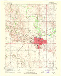
1969 Map of Tegarden SE
USGS Topo · Published 1971About this map
The Oklahoma plains of Woods County reveal a landscape transitioning into intensive energy extraction during the late 1960s. Across the townships of Alva, Jefferson, and Avard, the terrain is marked by a proliferation of Gas Wells and an Oil Well, signaling the industrial footprint on this prairie environment. This period shows the coexistence of established rural life with new mineral interests, as evidenced by the proximity of industrial sites to local landmarks like the Star Cem and Manila Cem.
Find a feature on this map
17 named features on this map. Tap any name to fly to it.
Don’t see what you’re looking for? This feature index may not catch every label — zoom into the map to look around manually.
Map Details
Editions of this 1969 Tegarden SE Map
This is the sole edition of this map. No revisions or reprints were ever made.
Other maps of this area

1955 · Woodward
USGS Topo · 1:250,000

1958 · Woodward
USGS Topo · 1:250,000

1969 · Tegarden NE
USGS Topo · 1:24,000

1969 · Waynoka NW
USGS Topo · 1:24,000

1969 · Tegarden NW
USGS Topo · 1:24,000

1969 · Hopeton
USGS Topo · 1:24,000

1969 · Avard
USGS Topo · 1:24,000

1969 · Alva NW
USGS Topo · 1:24,000

1969 · Tegarden
USGS Topo · 1:24,000
1969 · Alva
USGS Topo · 1:24,000