
1969 Map of Avard
USGS Topo · Published 1971About this map
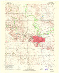
The railroad junction at Avard serves as the focal point of this Woods County survey, where the Atchison Topeka and Santa Fe and St Louis San Francisco lines intersect. This late 1960s landscape is defined by a transition from the drainage of Eagle Chief Creek in the north to a growing industrial presence in the south, evidenced by numerous Gas Wells and a Pipeline network.
Find a feature on this map
20 named features on this map. Tap any name to fly to it.
Don’t see what you’re looking for? This feature index may not catch every label — zoom into the map to look around manually.
Map Details
Editions of this 1969 Avard Map
This is the sole edition of this map. No revisions or reprints were ever made.
Other maps of this area

1955 · Woodward
USGS Topo · 1:250,000

1958 · Woodward
USGS Topo · 1:250,000

1969 · Tegarden SE
USGS Topo · 1:24,000

1969 · Dacoma SW
USGS Topo · 1:24,000

1969 · Waynoka NW
USGS Topo · 1:24,000

1969 · Hopeton
USGS Topo · 1:24,000

1969 · Waynoka East
USGS Topo · 1:24,000

1969 · Tegarden
USGS Topo · 1:24,000

1969 · Waynoka West
USGS Topo · 1:24,000
1969 · Alva
USGS Topo · 1:24,000