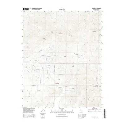
2015 Map of Tehachapi NE
USGS Topo · Published 2015About this map
Sugarloaf Mtn and Cache Peak dominate this high-desert terrain where the southern Sierra Nevada meets the western edge of the Mojave Desert. The landscape is deeply carved by numerous drainages, including Sand Canyon, Horse Canyon, and Pine Tree Canyon, which serve as critical conduits for seasonal water flow. Of particular interest to mineral collectors and geologists are the Horse Canyon Agate Beds, situated in the central portion of the sheet. Settlement patterns are concentrated in the southern sections, characterized by a grid of residential roads with distinctive names such as Melsetter Rd and Pretoria Rd. This area reflects a transition from the rugged mountain peaks to the more level desert floor, supported by vital water sources like Sweetwater Spring and Goodwater Spring that have long defined survival and settlement in this arid environment.
Find a feature on this map
66 named features on this map. Tap any name to fly to it.
Don’t see what you’re looking for? This feature index may not catch every label — zoom into the map to look around manually.
Map Details
Editions of this 2015 Tehachapi NE Map
This is the sole edition of this map. No revisions or reprints were ever made.
Other maps of this area
1915 · Mojave
USGS Topo · 1:125,000
1943 · Tehachapi
USGS Topo · 1:62,500
1943 · Cross Mountain
USGS Topo · 1:62,500
1943 · Emerald Mtn
USGS Topo · 1:62,500
1943 · Mojave
USGS Topo · 1:62,500
1947 · Mojave
USGS Topo · 1:24,000
1948 · Bakersfield
USGS Topo · 1:250,000
1955 · Bakersfield
USGS Topo · 1:250,000
1956 · Bakersfield
USGS Topo · 1:250,000
1956 · Mojave
USGS Topo · 1:62,500