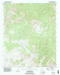
1992 Map of Tehachapi NE
USGS Topo · Published 1995About this map
Sugarloaf Mtn and Cache Peak define the high elevations of this eastern Kern County landscape, where the terrain is marked by a legacy of resource extraction and rugged utility. The map reveals an industrial fingerprint through numerous Prospects, a Quarry, and an Open Pit Mine in the western hills, alongside an Inclined Railway near the southern boundary. These features, coupled with the presence of multiple Generators, suggest a remote workspace reliant on specialized infrastructure.
Find a feature on this map
33 named features on this map. Tap any name to fly to it.
Don’t see what you’re looking for? This feature index may not catch every label — zoom into the map to look around manually.
Map Details
Editions of this 1992 Tehachapi NE Map
This is the sole edition of this map. No revisions or reprints were ever made.
Other maps of this area

1915 · Mojave
USGS Topo · 1:125,000

1943 · Tehachapi
USGS Topo · 1:62,500

1943 · Cross Mountain
USGS Topo · 1:62,500

1943 · Emerald Mtn
USGS Topo · 1:62,500

1943 · Mojave
USGS Topo · 1:62,500

1947 · Mojave
USGS Topo · 1:24,000

1948 · Bakersfield
USGS Topo · 1:250,000

1955 · Bakersfield
USGS Topo · 1:250,000

1956 · Bakersfield
USGS Topo · 1:250,000
1956 · Mojave
USGS Topo · 1:62,500