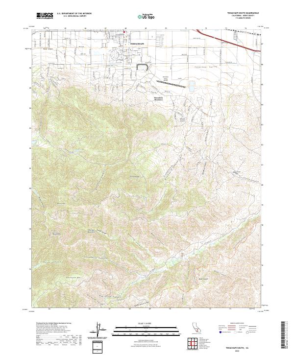
2022 Map of Tehachapi South
USGS Topo · Published 2022About this map
Tehachapi sits at a critical geographic junction where the Sierra Nevada meets the Tehachapi Mountains, serving as a high-altitude gateway between the Central Valley and the Mojave Desert. The landscape transition is stark, moving from the residential streets and small-town infrastructure of Tehachapi Valley into a complex network of steep canyons and ridgelines. Notable aviation history is represented by the Mountain Valley Airport, situated near the eastern edge of the primary settlement. To the south, the terrain becomes increasingly complex, dominated by peaks like Double Mtn and Covington Mtn. This area is defined by its deep drainages, including Antelope Canyon and Horsethief Canyon, which carve through the high country. The map illustrates a modern settlement pattern concentrated in the north, while the southern reaches remain defined by the natural contours of the mountain passes, including the historically significant Oak Creek Pass and Paradise Valley.
Find a feature on this map
114 named features on this map. Tap any name to fly to it.
Don’t see what you’re looking for? This feature index may not catch every label — zoom into the map to look around manually.
Map Details
Editions of this 2022 Tehachapi South Map
This is the sole edition of this map. No revisions or reprints were ever made.
Other maps of this area

1903 · Tejon
USGS Topo · 1:125,000

1914 · Caliente
USGS Topo · 1:125,000

1915 · Elizabeth Lake
USGS Topo · 1:125,000

1915 · Mojave
USGS Topo · 1:125,000

1917 · Elizabeth Lake
USGS Topo · 1:125,000

1943 · Tehachapi
USGS Topo · 1:62,500

1943 · Cummings Mountain
USGS Topo · 1:62,500

1943 · Neenach
USGS Topo · 1:62,500

1943 · Willow Springs
USGS Topo · 1:62,500

1948 · Bakersfield
USGS Topo · 1:250,000