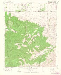
1966 Map of Tehachapi South
USGS Topo · Published 1967About this map
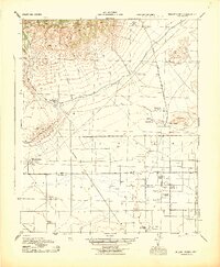
Tehachapi sits at the northern edge of this mid-1960s survey, marking the transition from the relatively flat Tehachapi Valley into the complex network of canyons and peaks of the Tehachapi Mountains. The map highlights a landscape defined by water management and resource extraction, featuring pipelines, an Aqueduct, and several water sources like Indian John Spring and Paradise Creek. Local infrastructure for the growing community is evidenced by Tompkins Sch and the Sherm Chitwood Reservoir.
Find a feature on this map
47 named features on this map. Tap any name to fly to it.
Don’t see what you’re looking for? This feature index may not catch every label — zoom into the map to look around manually.
Map Details
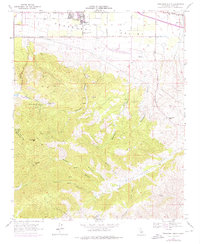
Editions of this 1966 Tehachapi South Map
2 editions found
Other maps of this area

1903 · Tejon
USGS Topo · 1:125,000

1914 · Caliente
USGS Topo · 1:125,000

1915 · Elizabeth Lake
USGS Topo · 1:125,000

1915 · Mojave
USGS Topo · 1:125,000

1917 · Elizabeth Lake
USGS Topo · 1:125,000

1943 · Tehachapi
USGS Topo · 1:62,500
1943 · Cummings Mountain
USGS Topo · 1:62,500
1943 · Neenach
USGS Topo · 1:62,500
1943 · Willow Springs
USGS Topo · 1:62,500

1948 · Bakersfield
USGS Topo · 1:250,000