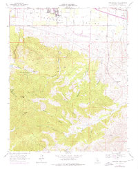
1966 Map of Tehachapi South
USGS Topo · Published 1976About this map
The high mountain environment of the southern Tehachapi Valley transitions from the growing outskirts of Tehachapi into a landscape defined by rugged peaks and deep drainage canyons. The industrial history of the region is evident in the presence of the Uncle Sam Mine and Pine Tree Mine, alongside several quarries and a Kiln located in the western hills. These extractive sites highlight the area's mid-century economic reliance on mineral resources beyond agriculture.
Find a feature on this map
49 named features on this map. Tap any name to fly to it.
Don’t see what you’re looking for? This feature index may not catch every label — zoom into the map to look around manually.
Map Details
Editions of this 1966 Tehachapi South Map
2 editions found
Other maps of this area

1903 · Tejon
USGS Topo · 1:125,000

1914 · Caliente
USGS Topo · 1:125,000

1915 · Elizabeth Lake
USGS Topo · 1:125,000

1915 · Mojave
USGS Topo · 1:125,000

1917 · Elizabeth Lake
USGS Topo · 1:125,000

1943 · Tehachapi
USGS Topo · 1:62,500

1943 · Cummings Mountain
USGS Topo · 1:62,500

1943 · Neenach
USGS Topo · 1:62,500

1943 · Willow Springs
USGS Topo · 1:62,500

1948 · Bakersfield
USGS Topo · 1:250,000