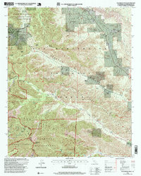
1996 Map of Telegraph Peak
USGS Topo · Published 1999About this map
Wrightwood and its surrounding mountain terrain are meticulously detailed in this late-twentieth-century revision. The map highlights the intersection of geology and history along the San Andreas Rift Zone, which carves through Lone Pine Canyon. High-altitude landmarks like Telegraph Peak, Thunder Mountain, and the Devils Backbone dominate the southern landscape, while the lower elevations reveal a network of remote ranching outposts including Niles Ranch, Prudhon Ranch, and Sharpless Ranch.
Find a feature on this map
55 named features on this map. Tap any name to fly to it.
Don’t see what you’re looking for? This feature index may not catch every label — zoom into the map to look around manually.
Map Details
Editions of this 1996 Telegraph Peak Map
This is the sole edition of this map. No revisions or reprints were ever made.
Other maps of this area

1896 · San Bernardino
USGS Topo · 1:62,500

1897 · Cucamonga
USGS Topo · 1:62,500

1898 · San Bernardino
USGS Topo · 1:62,500

1900 · Cucamonga
USGS Topo · 1:62,500

1901 · Southern California Sheet No. 1
USGS Topo · 1:250,000

1901 · San Bernardino
USGS Topo · 1:62,500

1902 · Hesperia
USGS Topo · 1:62,500

1903 · Cucamonga
USGS Topo · 1:62,500

1903 · San Antonio
USGS Topo · 1:62,500

1904 · Southern California Sheet No. 1
USGS Topo · 1:250,000