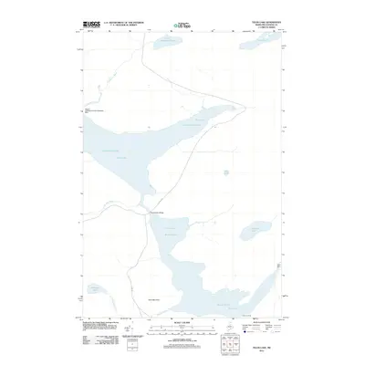
2011 Map of Telos Lake
USGS Topo · Published 2011About this map
Chamberlain Lake and Telos Lake dominate this North Maine Woods landscape, reflecting a region defined by water and forest management. The presence of the Nugent Chamberlain Lake Seaplane Base on the western shore of Chamberlain Lake highlights the area's reliance on air travel for access. Historical infrastructure is evident at the Chamberlain Bridge and the Telos Dam, components of the 19th-century water diversions used for log driving. These features, along with Telos Landing, mark the points where industry and navigation meet the wilderness. The terrain rises to Telos Mountain in the south, overlooking a series of smaller water bodies such as Round Pond, Midnight Pond, and Coffeelos Pond. The Telos Rd provides the primary overland artery through this remote timberland territory.
Find a feature on this map
17 named features on this map. Tap any name to fly to it.
Don’t see what you’re looking for? This feature index may not catch every label — zoom into the map to look around manually.
Map Details
Editions of this 2011 Telos Lake Map
This is the sole edition of this map. No revisions or reprints were ever made.
Other maps of this area

1953 · Telos Lake
USGS Topo · 1:62,500

1954 · Chesuncook
USGS Topo · 1:62,500

1954 · Spider Lake
USGS Topo · 1:62,500

1954 · Churchill Lake
USGS Topo · 1:62,500

1954 · Presque Isle
USGS Topo · 1:250,000

1957 · Telos Lake
USGS Topo · 1:62,500

1958 · Presque Isle
USGS Topo · 1:250,000

1958 · Chesuncook
USGS Topo · 1:62,500

1960 · Presque Isle
USGS Topo · 1:250,000

1961 · Spider Lake
USGS Topo · 1:62,500