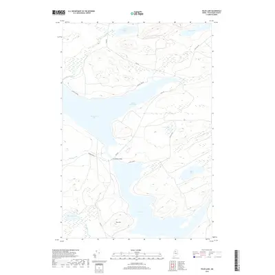
2018 Map of Telos Lake
USGS Topo · Published 2018About this map
Chamberlain Lake and Telos Lake dominate this North Woods landscape in Piscataquis County, connected by a narrow waterway at the Chamberlain Bridge. The terrain is defined by the significant rise of Telos Mtn to the south and a network of interior ponds including Imlos Pond and Coffeelos Pond. This area represents a critical corridor for timber and recreation, as evidenced by the primitive road network consisting of Telos Rd, Coffee Los Rd, and Nugents Camp Rd. The hydrology is complex, with Leadbetter Brook and Midnight Brook feeding into the larger lakes. This survey documents the persistent wilderness character of the T7 R12 WELS region, where the industrial history of log driving and early sporting camps has left a footprint of named water bodies and access routes that remain central to the geography today.
Find a feature on this map
18 named features on this map. Tap any name to fly to it.
Don’t see what you’re looking for? This feature index may not catch every label — zoom into the map to look around manually.
Map Details
Editions of this 2018 Telos Lake Map
This is the sole edition of this map. No revisions or reprints were ever made.
Other maps of this area

1953 · Telos Lake
USGS Topo · 1:62,500

1954 · Chesuncook
USGS Topo · 1:62,500

1954 · Spider Lake
USGS Topo · 1:62,500

1954 · Churchill Lake
USGS Topo · 1:62,500

1954 · Presque Isle
USGS Topo · 1:250,000

1957 · Telos Lake
USGS Topo · 1:62,500

1958 · Presque Isle
USGS Topo · 1:250,000

1958 · Chesuncook
USGS Topo · 1:62,500

1960 · Presque Isle
USGS Topo · 1:250,000

1961 · Spider Lake
USGS Topo · 1:62,500