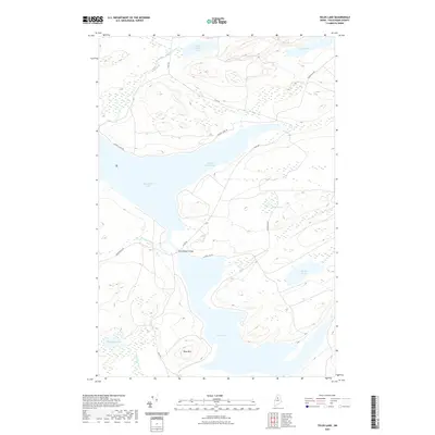
2021 Map of Telos Lake
USGS Topo · Published 2021About this map
Chamberlain Lake and Telos Lake dominate this northern Maine wilderness, connected by the narrow passage at Chamberlain Bridge. The landscape is a network of interconnected waterways and logging roads, including Telos Rd and Coffee Los Rd, which weave through the timberlands. Elevations rise significantly at Telos Mtn, overlooking a cluster of smaller water bodies such as Midnight Pond, Coffeelos Pond, and Telos Pond. The drainage patterns here are complex, with Kellogg Brook and Leadbetter Brook feeding into the larger basins. This area has long served as a critical corridor for the timber industry, where the geography of the lakes and ponds dictated the movement of logs and men through the North Maine Woods.
Find a feature on this map
19 named features on this map. Tap any name to fly to it.
Don’t see what you’re looking for? This feature index may not catch every label — zoom into the map to look around manually.
Map Details
Editions of this 2021 Telos Lake Map
This is the sole edition of this map. No revisions or reprints were ever made.
Other maps of this area

1953 · Telos Lake
USGS Topo · 1:62,500

1954 · Chesuncook
USGS Topo · 1:62,500

1954 · Spider Lake
USGS Topo · 1:62,500

1954 · Churchill Lake
USGS Topo · 1:62,500

1954 · Presque Isle
USGS Topo · 1:250,000

1957 · Telos Lake
USGS Topo · 1:62,500

1958 · Presque Isle
USGS Topo · 1:250,000

1958 · Chesuncook
USGS Topo · 1:62,500

1960 · Presque Isle
USGS Topo · 1:250,000

1961 · Spider Lake
USGS Topo · 1:62,500