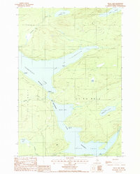
1988 Map of Telos Lake
USGS Topo · Published 1988About this map
The Allagash Wilderness Waterway anchors this interior landscape, following a chain of major water bodies that include Chamberlain Lake and Telos Lake. During the late twentieth century, this region remained a critical corridor for backcountry recreation and water management, evidenced by the cluster of specialized sites such as the Ranger Station and the Boy Scout Campsite near the Round Pond thoroughfare.
Find a feature on this map
33 named features on this map. Tap any name to fly to it.
Don’t see what you’re looking for? This feature index may not catch every label — zoom into the map to look around manually.
Map Details
Editions of this 1988 Telos Lake Map
This is the sole edition of this map. No revisions or reprints were ever made.
Other maps of this area

1953 · Telos Lake
USGS Topo · 1:62,500

1954 · Chesuncook
USGS Topo · 1:62,500

1954 · Spider Lake
USGS Topo · 1:62,500

1954 · Churchill Lake
USGS Topo · 1:62,500

1954 · Presque Isle
USGS Topo · 1:250,000

1957 · Telos Lake
USGS Topo · 1:62,500

1958 · Presque Isle
USGS Topo · 1:250,000

1958 · Chesuncook
USGS Topo · 1:62,500

1960 · Presque Isle
USGS Topo · 1:250,000

1961 · Spider Lake
USGS Topo · 1:62,500