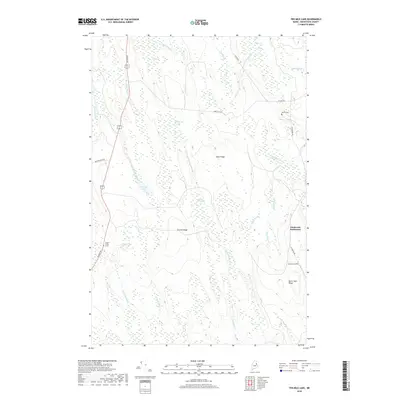
2018 Map of Ten Mile Lake
USGS Topo · Published 2018About this map
Estabrook Settlement and the surrounding woodlands of Aroostook County are defined by a complex network of glacial hydrology and high ground. The landscape is structured around prominent elevations like Sugar Ridge, Stetson Ridge, and Burnt Dam Ridge, which separate various wetlands and water bodies. Significant water features include Tenmile Lake and Elevenmile Lake, along with the Meduxnekeag Stream and its southern branch. Local history is anchored by the Wilcox Cem and Estabrook Cem, while the isolated Hiram T Smith Grave near Bangor Rd offers a specific point of interest for genealogists. The region is characterized by extensive bogs, such as Jimmy Brook Bog and Coffin Bog, indicating a landscape largely shaped by its drainage patterns into the various brooks and streams that crisscross the territory.
Find a feature on this map
33 named features on this map. Tap any name to fly to it.
Don’t see what you’re looking for? This feature index may not catch every label — zoom into the map to look around manually.
Map Details
Editions of this 2018 Ten Mile Lake Map
This is the sole edition of this map. No revisions or reprints were ever made.
Other maps of this area

1937 · Smyrna Mills
USGS Topo · 1:62,500

1938 · Houlton
USGS Topo · 1:62,500

1940 · Amity
USGS Topo · 1:62,500

1941 · Amity
USGS Topo · 1:62,500

1941 · Mattawamkeag Lake
USGS Topo · 1:62,500

1943 · Amity
USGS Topo · 1:62,500

1943 · Mattawamkeag Lake
USGS Topo · 1:62,500

1951 · Houlton
USGS Topo · 1:62,500

1954 · Presque Isle
USGS Topo · 1:250,000

1954 · Millinocket
USGS Topo · 1:250,000