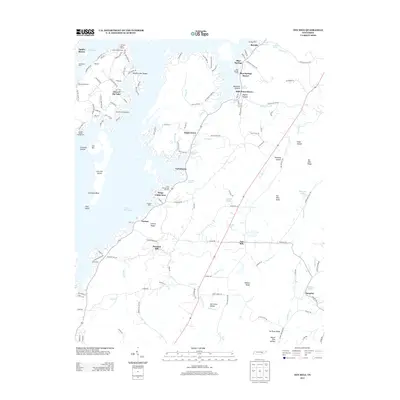
2013 Map of Ten Mile
USGS Topo · Published 2013About this map
Watts Bar Lake defines the western edge of this landscape, where the Tennessee River's impoundment created a complex shoreline of inlets and islands. Along the water, established recreational and residential clusters like Eden of the Lake, Apollo Shores, and Blue Springs Resort sit alongside long-standing institutions such as Cedine Bible Camp. Moving inland, the terrain transitions into a series of ridges and hollows, including Hurricane Valley and Woolsey Hollow, which channel local waters like Ten Mile Creek and Hurricane Creek.
Find a feature on this map
146 named features on this map. Tap any name to fly to it.
Don’t see what you’re looking for? This feature index may not catch every label — zoom into the map to look around manually.
Map Details
Editions of this 2013 Ten Mile Map
This is the sole edition of this map. No revisions or reprints were ever made.
Other maps of this area

1887 · Kingston
USGS Topo · 1:125,000

1891 · Kingston
USGS Topo · 1:125,000

1893 · Kingston
USGS Topo · 1:125,000

1935 · Niota
USGS Topo · 1:24,000

1935 · Rockwood
USGS Topo · 1:24,000

1935 · Decatur
USGS Topo · 1:24,000

1936 · Roddy
USGS Topo · 1:24,000

1936 · Spring City
USGS Topo · 1:24,000
1936 · Pattie Gap
USGS Topo · 1:24,000
1936 · Ten Mile
USGS Topo · 1:24,000