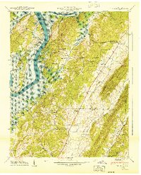
1940 Map of Ten Mile
USGS Topo · Published 1940About this map
The Tennessee River winds through the heart of the Tennessee Valley in 1940, defining the borders where Roane, Meigs, and Rhea counties meet. This survey captures a landscape undergoing significant change as the Watts Bar Reservoir begins to shape the river's character. The valley is dotted with small rural centers like Ten Mile and Cross Key, supported by local institutions such as Ten Mile Sch and Cross Key Chapel.
Find a feature on this map
49 named features on this map. Tap any name to fly to it.
Don’t see what you’re looking for? This feature index may not catch every label — zoom into the map to look around manually.
Map Details
Editions of this 1940 Ten Mile Map
This is the sole edition of this map. No revisions or reprints were ever made.
Other maps of this area

1887 · Kingston
USGS Topo · 1:125,000

1891 · Kingston
USGS Topo · 1:125,000

1893 · Kingston
USGS Topo · 1:125,000

1935 · Niota
USGS Topo · 1:24,000

1935 · Rockwood
USGS Topo · 1:24,000

1935 · Decatur
USGS Topo · 1:24,000

1936 · Roddy
USGS Topo · 1:24,000

1936 · Spring City
USGS Topo · 1:24,000
1936 · Pattie Gap
USGS Topo · 1:24,000
1936 · Ten Mile
USGS Topo · 1:24,000