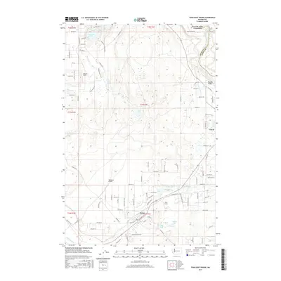
2017 Map of Tenalquot Prairie
USGS Topo · Published 2017About this map
Tenalquot Prairie dominates the landscape of this Thurston County region, where the prairie's open spaces are bounded by the winding Deschutes River to the southwest and the Nisqually River to the northeast. The 2017 survey details the growth of Yelm and Rainier, two distinct communities connected by a network of rural roads such as Rainier Road SE and Yelm Highway SE. Significant water infrastructure is evident in the Centralia Canal near North Yelm, while the presence of Lake Saint Clair and numerous smaller bodies like McClure Lake and Gehrke Lake highlight the area's complex glacial topography. Aviation interests are well-represented by the LZ Ranch Airport and Taylor Airport, serving the local community. The northern edge of the map features the Nisqually Indian Community along the river, providing a look at tribal lands and local boundaries alongside the Thurston and Pierce county lines.
Find a feature on this map
102 named features on this map. Tap any name to fly to it.
Don’t see what you’re looking for? This feature index may not catch every label — zoom into the map to look around manually.
Map Details
Editions of this 2017 Tenalquot Prairie Map
This is the sole edition of this map. No revisions or reprints were ever made.
Other maps of this area

1916 · Chehalis
USGS Topo · 1:125,000

1937 · Olympia
USGS Topo · 1:62,500

1940 · Tenino
USGS Topo · 1:62,500

1940 · Anderson Island
USGS Topo · 1:62,500

1944 · Tenino
USGS Topo · 1:62,500

1944 · Yelm
USGS Topo · 1:62,500

1948 · Anderson Island
USGS Topo · 1:62,500

1948 · Fort Lewis
USGS Topo · 1:24,000

1948 · Nisqually
USGS Topo · 1:24,000

1949 · Yelm
USGS Topo · 1:62,500