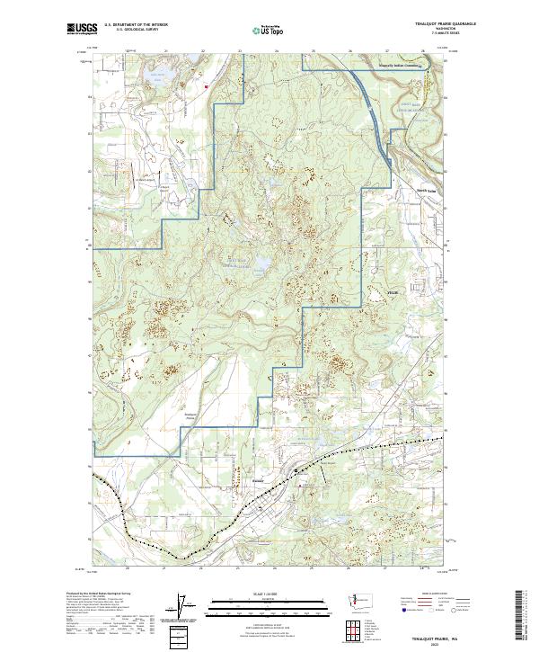
2023 Map of Tenalquot Prairie
USGS Topo · Published 2023About this map
Tenalquot Prairie dominates this landscape in Thurston County, where the transition from prairie to woodland is punctuated by glacial kettle lakes like Fiander Lake and Cat Lakes. The northern reaches are defined by the Nisqually River and the neighboring Nisqually Indian Community, while the southern end is anchored by the settlement of Rainier. This modern survey reveals a complex mosaic of land use, from the residential grids of Yelm and North Yelm to the extensive military reservation of Joint Base Lewis-Mcchord.
Find a feature on this map
54 named features on this map. Tap any name to fly to it.
Don’t see what you’re looking for? This feature index may not catch every label — zoom into the map to look around manually.
Map Details
Editions of this 2023 Tenalquot Prairie Map
This is the sole edition of this map. No revisions or reprints were ever made.
Other maps of this area

1916 · Chehalis
USGS Topo · 1:125,000

1937 · Olympia
USGS Topo · 1:62,500

1940 · Tenino
USGS Topo · 1:62,500

1940 · Anderson Island
USGS Topo · 1:62,500

1944 · Tenino
USGS Topo · 1:62,500

1944 · Yelm
USGS Topo · 1:62,500

1948 · Anderson Island
USGS Topo · 1:62,500

1948 · Fort Lewis
USGS Topo · 1:24,000

1948 · Nisqually
USGS Topo · 1:24,000

1949 · Yelm
USGS Topo · 1:62,500