
1949 Map of Tenino
USGS Topo · Published 1958About this map
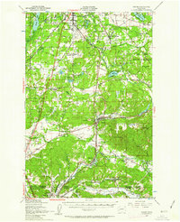
Tenino and the southern reaches of Thurston County appear here as a significant rail and prairie landscape in the late 1940s. The map illustrates a complex network of heavy rail infrastructure, including the Northern Pacific, Great Northern, and Union Pacific lines intersecting at Western Junction. This region is defined by distinct open areas such as Bush Prairie, Chambers Prairie, and Mound Prairie, where early transportation history is commemorated by the Oregon Trail Monument.
Find a feature on this map
72 named features on this map. Tap any name to fly to it.
Don’t see what you’re looking for? This feature index may not catch every label — zoom into the map to look around manually.
Map Details
Editions of this 1949 Tenino Map
2 editions found
Other maps of this area

1916 · Chehalis
USGS Topo · 1:125,000

1937 · Olympia
USGS Topo · 1:62,500

1939 · Shelton
USGS Topo · 1:62,500

1940 · Tenino
USGS Topo · 1:62,500

1940 · Anderson Island
USGS Topo · 1:62,500

1941 · Meskill
USGS Topo · 1:62,500

1941 · Gate
USGS Topo · 1:62,500

1943 · Willapa
USGS Topo · 1:62,500

1944 · Tenino
USGS Topo · 1:62,500

1944 · Yelm
USGS Topo · 1:62,500