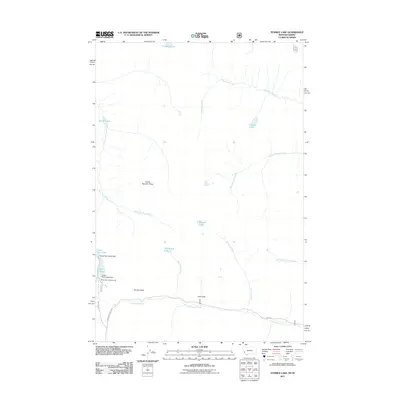
2011 Map of Tenmile Lake
USGS Topo · Published 2011About this map
Tenmile Lake sits at the heart of this high-elevation landscape, where a complex network of alpine waters feeds the Bitterroot drainage system. The terrain is defined by dramatic geologic features such as Divide Number Three and the notable Poverty Slide, illustrating the active mountain environment of western Montana. To the west, the managed waters of Twin Lakes are regulated by the Upper Twin Lakes Dam and Lower Twin Lakes Dam, supporting local water needs and recreation at Schumaker Campground. A legacy of early exploration and naming is evident in landmarks like the Ohio Side and the remote Ingomar Lake. The area is accessible via the winding Lost Horse Rd, which follows Lost Horse Creek through the canyon, providing a primary corridor into this watershed of namesake lakes including Twelvemile Lake and Blodgett Lake.
Find a feature on this map
22 named features on this map. Tap any name to fly to it.
Don’t see what you’re looking for? This feature index may not catch every label — zoom into the map to look around manually.
Map Details
Editions of this 2011 Tenmile Lake Map
This is the sole edition of this map. No revisions or reprints were ever made.
Other maps of this area

1901 · Hamilton
USGS Topo · 1:125,000

1911 · Lolo
USGS Topo · 1:250,000

1913 · Lolo
USGS Topo · 1:250,000

1956 · Hamilton
USGS Topo · 1:250,000

1959 · Hamilton
USGS Topo · 1:250,000

1960 · Hamilton
USGS Topo · 1:250,000

1964 · Hamilton
USGS Topo · 1:250,000

1964 · Tenmile Lake
USGS Topo · 1:24,000

1964 · Ward Mountain
USGS Topo · 1:24,000
1964 · El Capitan
USGS Topo · 1:24,000