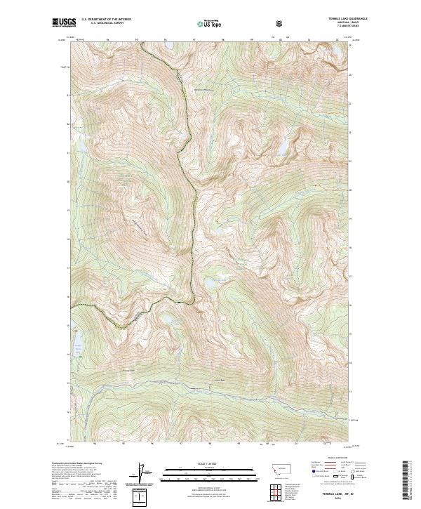
2024 Map of Tenmile Lake
USGS Topo · Published 2024About this map
Tenmile Lake and Twelvemile Lake anchor this high-elevation mountain terrain where the Idaho Montana state line follows the crest of the Bitterroot Mountains. The landscape is defined by its dramatic glacial features and the overlapping boundaries of the Bitterroot National Forest, Nez-Perce National Forest, and the Selway-Bitterroot Wilderness. A network of backcountry access points is visible, including the Sawtooth Trl and Roaring Lion Trl, which navigate the steep drainage basins of Sawtooth Creek and Roaring Lion Creek. Notable geomorphic features such as Poverty Slide and the Ohio Side suggest the dynamic nature of the slopes above Lost Horse Creek. This survey captures the remote character of the Bitterroot Divide, where transport is limited to rugged routes like Lost Horse Rd and Twin Lakes Rd, serving as a record of these protected wilderness corridors.
Find a feature on this map
54 named features on this map. Tap any name to fly to it.
Don’t see what you’re looking for? This feature index may not catch every label — zoom into the map to look around manually.
Map Details
Editions of this 2024 Tenmile Lake Map
This is the sole edition of this map. No revisions or reprints were ever made.
Other maps of this area

1901 · Hamilton
USGS Topo · 1:125,000

1911 · Lolo
USGS Topo · 1:250,000

1913 · Lolo
USGS Topo · 1:250,000

1956 · Hamilton
USGS Topo · 1:250,000

1959 · Hamilton
USGS Topo · 1:250,000

1960 · Hamilton
USGS Topo · 1:250,000

1964 · Hamilton
USGS Topo · 1:250,000

1964 · Tenmile Lake
USGS Topo · 1:24,000

1964 · Ward Mountain
USGS Topo · 1:24,000
1964 · El Capitan
USGS Topo · 1:24,000