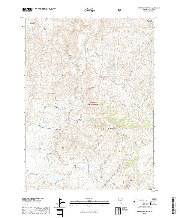
2021 Map of Tennessee Mountain
USGS Topo · Published 2021About this map
The Humboldt National Forest dominates this northern Nevada landscape, where high summits and specialized mountain trails define the geography. Centered around Tennessee Mtn and the Tennessee Mine, the area shows a complex network of forest service routes including the Tennessee 4 Trl and the Mill Creek Loop. These paths suggest a history of high-altitude extraction and land management, particularly near Waterlog Summit and the distinctive open expanse of Sunflower Flat.
Find a feature on this map
70 named features on this map. Tap any name to fly to it.
Don’t see what you’re looking for? This feature index may not catch every label — zoom into the map to look around manually.
Map Details
Editions of this 2021 Tennessee Mountain Map
This is the sole edition of this map. No revisions or reprints were ever made.
Other maps of this area

1935 · Charleston
USGS Topo · 1:48,000

1936 · Mountain City
USGS Topo · 1:62,500

1936 · Rowland
USGS Topo · 1:48,000

1940 · Rowland
USGS Topo · 1:62,500

1940 · Mountain City
USGS Topo · 1:62,500

1942 · Mt. Velma
USGS Topo · 1:62,500

1955 · Wells
USGS Topo · 1:250,000

1956 · Wild Horse
USGS Topo · 1:62,500

1958 · Wells
USGS Topo · 1:250,000

1961 · Wells
USGS Topo · 1:250,000