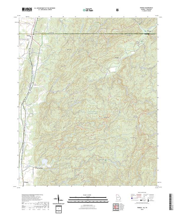
2024 Map of Tennga
USGS Topo · Published 2024About this map
Cohutta Springs and the surrounding wilderness of northern Georgia anchor this landscape where the Cherokee National Forest meets the Chattahoochee National Forest. This borderlands region is defined by the high ridges of Doogan Mtn and Peaky Top, which overlook the winding course of the Conasauga River as it flows south into Murray County. Small settlements such as Tennga, Cisco, and Crandall dot the western valleys along the highway corridors, while the eastern portion of the sheet is dominated by the primitive reaches of the Cohutta Wilderness. The presence of Summerour Church Rd and family-named features like Alaculsy Valley point to a long-standing rural community structure. Local infrastructure includes the Rostex Airport and a network of forest trails like the Lost Silver Mine Rd and the Iron Mountain Trl, which provide access to the gap-heavy terrain of Chicken Coop Gap and Paint Bank Gap.
Find a feature on this map
79 named features on this map. Tap any name to fly to it.
Don’t see what you’re looking for? This feature index may not catch every label — zoom into the map to look around manually.
Map Details
Editions of this 2024 Tennga Map
This is the sole edition of this map. No revisions or reprints were ever made.
Other maps of this area

1886 · Dalton
USGS Topo · 1:125,000

1886 · Cleveland
USGS Topo · 1:125,000

1892 · Cleveland
USGS Topo · 1:125,000

1892 · Dalton
USGS Topo · 1:125,000

1895 · Cleveland
USGS Topo · 1:125,000

1897 · Dalton
USGS Topo · 1:125,000

1901 · Cleveland
USGS Topo · 1:125,000

1911 · Cohutta Mtn
USGS Topo · 1:62,500

1913 · Cohutta Mtn.
USGS Topo · 1:62,500
1935 · Hemp Top
USGS Topo · 1:24,000