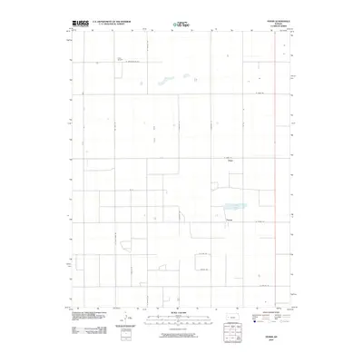
2009 Map of Tennis
USGS Topo · Published 2009About this map
The High Plains landscape of western Kansas is documented here during a period of modern agricultural development, defined by a rigid grid of section-line roads and sparse prairie settlements. The small communities of Tennis and Gano serve as the primary hubs in this part of Finney County, with the local economy largely dependent on the surrounding farm and ranch land. Unusual for such a dry region, the presence of Corrigan Lake provides a notable hydrologic feature in the south-central portion of the map.
Find a feature on this map
21 named features on this map. Tap any name to fly to it.
Don’t see what you’re looking for? This feature index may not catch every label — zoom into the map to look around manually.
Map Details
Editions of this 2009 Tennis Map
This is the sole edition of this map. No revisions or reprints were ever made.
Other maps of this area

1940 · Scott City
USGS Topo · 1:62,500

1941 · Modoc
USGS Topo · 1:62,500

1944 · Tennis
USGS Topo · 1:62,500

1951 · Scott City
USGS Topo · 1:62,500

1951 · Modoc
USGS Topo · 1:62,500

1955 · Scott City
USGS Topo · 1:250,000

1958 · Scott City
USGS Topo · 1:250,000
1965 · Wolf
USGS Topo · 1:24,000

1965 · Wolf NE
USGS Topo · 1:24,000
1976 · Lowe
USGS Topo · 1:24,000