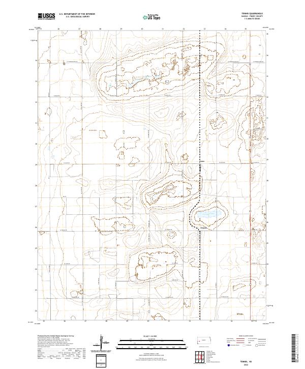
2022 Map of Tennis
USGS Topo · Published 2022About this map
Tennis and Gano sit within the expansive agricultural landscape of Finney County, where the High Plains are defined by a strict section-line road grid and seasonal water features. The terrain is notably punctuated by isolated depressions that form Corrigan Lake and Sondreagger Lake, providing rare hydrologic variety in an area otherwise dominated by large-scale farming. Named family roads such as N Chimelka Rd, N Sherlock Rd, and Big Lowe Rd provide a clear genealogical record of the local landholders and families who established these rural routes. This 2022 survey shows the persistent layout of western Kansas townships, illustrating how historical property boundaries and irrigation-ready fields continue to dictate the placement of local infrastructure and small settlements.
Find a feature on this map
31 named features on this map. Tap any name to fly to it.
Don’t see what you’re looking for? This feature index may not catch every label — zoom into the map to look around manually.
Map Details
Editions of this 2022 Tennis Map
This is the sole edition of this map. No revisions or reprints were ever made.
Other maps of this area

1940 · Scott City
USGS Topo · 1:62,500

1941 · Modoc
USGS Topo · 1:62,500

1944 · Tennis
USGS Topo · 1:62,500

1951 · Scott City
USGS Topo · 1:62,500

1951 · Modoc
USGS Topo · 1:62,500

1955 · Scott City
USGS Topo · 1:250,000

1958 · Scott City
USGS Topo · 1:250,000
1965 · Wolf
USGS Topo · 1:24,000

1965 · Wolf NE
USGS Topo · 1:24,000
1976 · Lowe
USGS Topo · 1:24,000