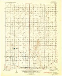
1944 Map of Tennis
USGS Topo · Published 1944About this map
Tennis and the surrounding high plains of Finney County are defined by a sophisticated network of irrigation canals essential for Western Kansas agriculture. The landscape is carved by the Garden City Ditch, Eastern Ditch, and the Great Western Ditch, which trace the contours of the land south of Terry Pleasant Valley. These waterworks supported small rural settlements and a series of one-room schoolhouses that once anchored this community, including Veteran Sch, Roxana Sch, and Lake Valley Sch.
Find a feature on this map
24 named features on this map. Tap any name to fly to it.
Don’t see what you’re looking for? This feature index may not catch every label — zoom into the map to look around manually.
Map Details
Editions of this 1944 Tennis Map
2 editions found
Other maps of this area

1891 · Larned
USGS Topo · 1:125,000

1896 · Garden
USGS Topo · 1:125,000

1900 · Lakin
USGS Topo · 1:125,000

1940 · Scott City
USGS Topo · 1:62,500

1941 · Modoc
USGS Topo · 1:62,500

1944 · Tennis
USGS Topo · 1:62,500

1951 · Scott City
USGS Topo · 1:62,500

1951 · Modoc
USGS Topo · 1:62,500

1955 · Dodge City
USGS Topo · 1:250,000

1955 · Scott City
USGS Topo · 1:250,000