
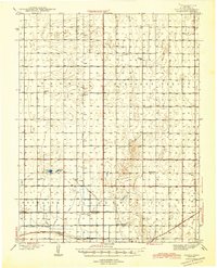
1944 Map of Tennis
USGS Topo · Published 1944About this map
Great Eastern Ditch and Farmers Ditch cut across the flat Finney County landscape, revealing the critical role of irrigation in this western Kansas agricultural region during the early 1940s. The Atchison Topeka and Santa Fe railroad provides the primary backbone for transportation, connecting small rural hubs like Tennis and Gillespie. These clusters of settlement are often centered around local rural schools, such as Pleasant View Sch and Roxana Sch, which served the scattered farmsteads of Terry and Sherlock townships.
Find a feature on this map
23 named features on this map. Tap any name to fly to it.
Don’t see what you’re looking for? This feature index may not catch every label — zoom into the map to look around manually.
Map Details
Editions of this 1944 Tennis Map
2 editions found
Other maps of this area

1891 · Larned
USGS Topo · 1:125,000

1896 · Garden
USGS Topo · 1:125,000

1900 · Lakin
USGS Topo · 1:125,000

1940 · Scott City
USGS Topo · 1:62,500

1941 · Modoc
USGS Topo · 1:62,500

1951 · Scott City
USGS Topo · 1:62,500

1951 · Modoc
USGS Topo · 1:62,500

1955 · Dodge City
USGS Topo · 1:250,000

1955 · Scott City
USGS Topo · 1:250,000

1958 · Dodge City
USGS Topo · 1:250,000